Image 1 of 2
 Image 2 of 2
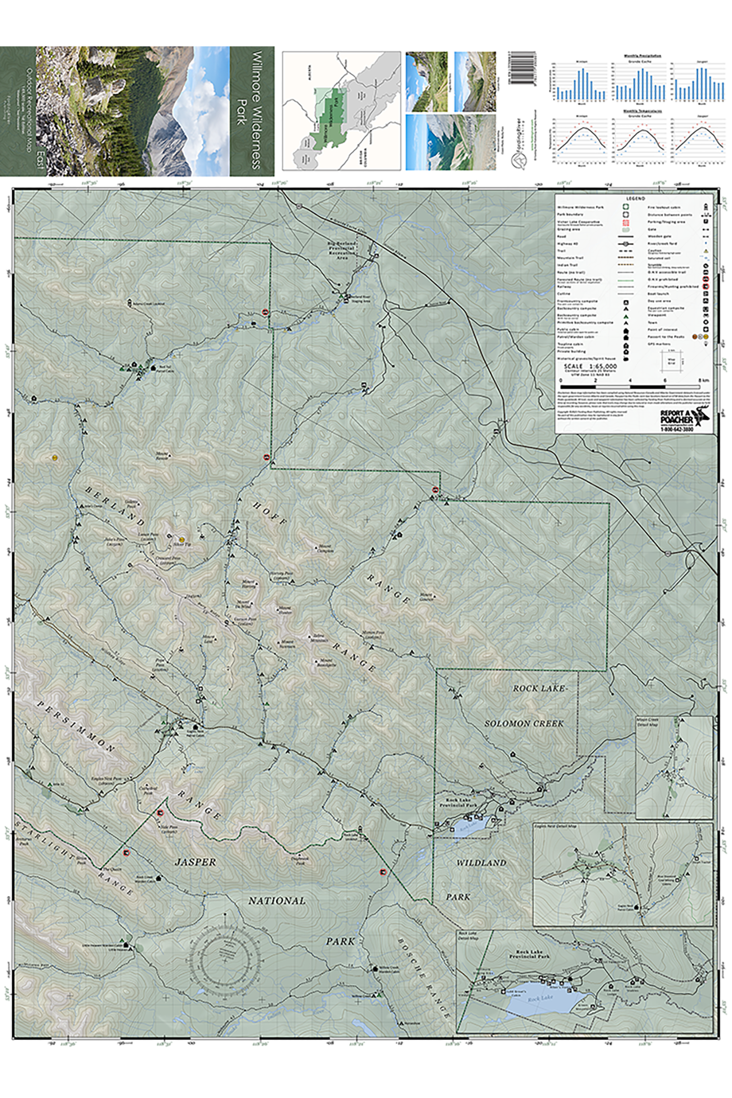
The first detailed map for the eastern half of Willmore Wilderness Park, with more than 600 km of established trails and routes surveyed-making it the most accurate and comprehensive map to date.
Map Includes:
585 km of established trails
57 km of cross-country routes
Over 100 campsites
Horse corrals and grazing areas
Historical buildings and grave-sites
Passport to the Peaks cairn box locations
Ford locations
GPS coordinates for unmarked trails and junctions
Precipitation and temperature charts
3 detailed inset maps for Rock Lake, Eagles Nest and Moon Creek
Park access trails from Cowlick Creek, Berland River, Little Berland River, Rock Lake and Jasper National Park
Product Details:
Scale: 1:65,000
Contour interval: 25 m
Size (folded): 9.5” x 4.5” (24.1 cm x 11.4 cm)
Size (flat): 35” x 25.5” (88.9 cm x 64.8 cm)
Weight: 44 g
Synthetic, waterproof and tear-resistant paper
ISBN 978-1-7770908-0-7
Shipping:
Product ships via Canada Post letter mail
Delivery time: 2-4 business days within Canada & 4-7 business days to the U.S.A