 Image 1 of 2
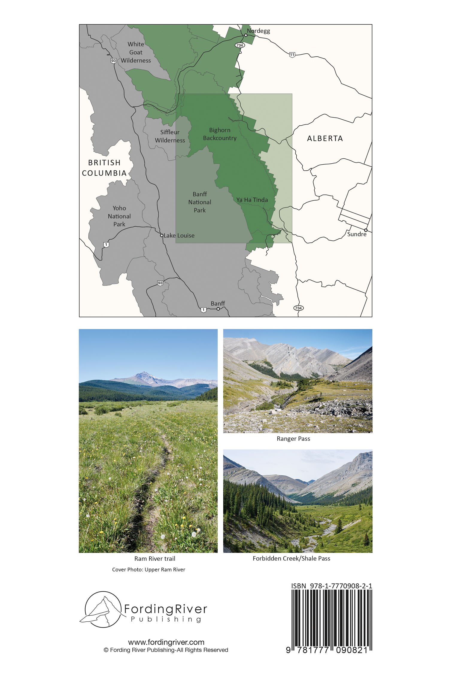 Image 2 of 2
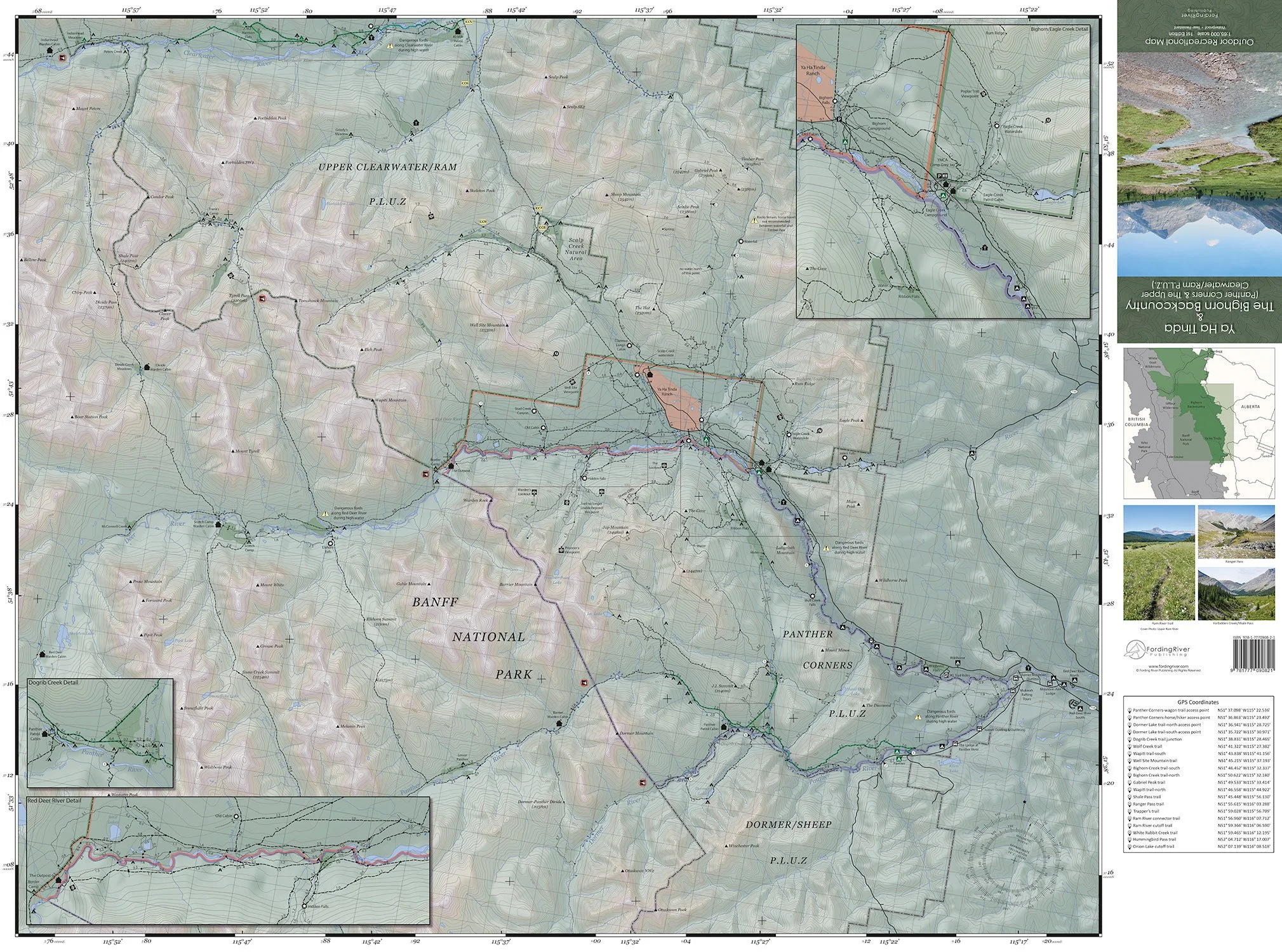
The first comprehensive map of Ya Ha Tinda and Upper Clearwater/Ram & Panther Corners Public Land Use Zones. This map provides a detailed survey of over 1,100 km of trails and routes between the North Ram and Panther rivers in the Front Range of the Canadian Rockies.
Map Includes:
Over 1,100 km of established trails and routes
Over 200 campsites, including campsites with horse corrals, highlines and tie stalls
Grazing areas
OHV and horse wagon trails
Trapline cabins, patrol cabins, warden cabins & fire lookouts
Complete Bivouac summit listing
Ford locations
GPS coordinates for unmarked trails and junctions
6 detailed inset maps for the Clearwater River, Red Deer River, Panther River, Hummingbird Creek, Dogrib Creek and Bighorn/Eagle Creeks
Main access points from Hummingbird Creek, Cut-off Creek, Red Deer River and Panther River
100% GPS verified trails and routes
Product Details:
Scale: 1:65,000
Detailed inset map scale: 1:30,000
Contour intervals: 25 m
Size (folded): 9.25” x 4.5” (23.5 cm x 11.4 cm)
Size (flat): 35” x 26” (88.9 cm x 66 cm)
Weight: 55 g
Synthetic, waterproof and tear-resistant paper
ISBN 978-1-7770908-2-1
Shipping:
Product ships via Canada Post letter mail
Delivery time: 2-4 business days within Canada & 4-7 business days to the U.S.A